Moralized Cartography
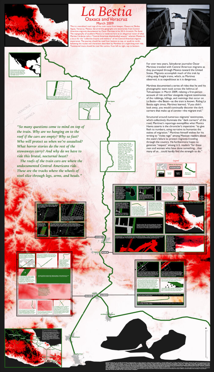
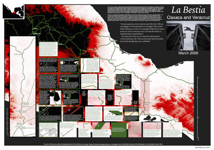
I am developing a series of digital maps that I call “moralized road maps.” My first map, “La Bestia,” built using QGIS, depicts the migration route from Central America to the United States by charting a chapter from Salvadoran journalist Óscar Martínez’s 2010 book Los migrantes que no importan (translated into English as The Beast in 2013). Inspired by Potawatomi geographer Margaret Pearce’s “emotional geographies” of colonial Canada, and by medieval and early-modern allegorical geographies, moralized road maps are intended to be a critical cartography that uses the map as a document for geographic witnessing, in which the allegorical view from nowhere is implicated in moral reflection.
Environmental Humanities Cartography
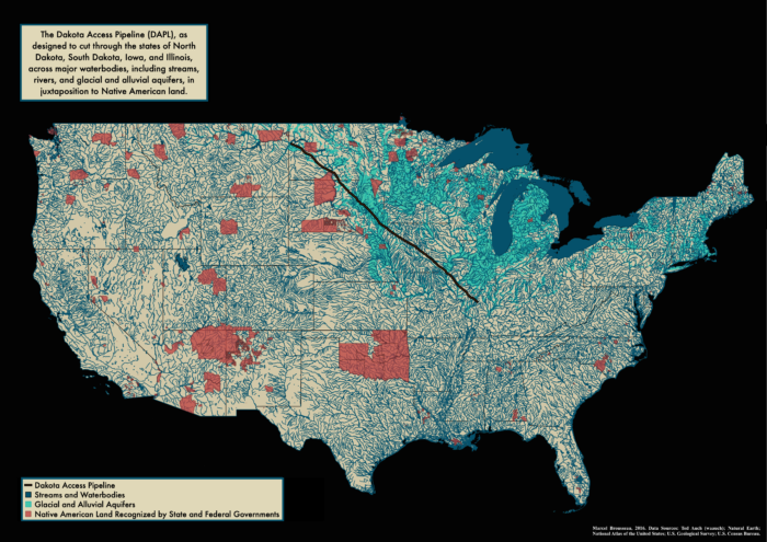
During the Dakota Access Pipeline (DAPL) protests of 2016-17, I produced an interpretive map of the pipeline, juxtaposing its geographic extent with the fragile water resources of the contiguous United States and with federal- and state-recognized Indigenous lands. As a mode of analysis, this map allowed me to understand the intimacy and scarcity of water resources, particularly the glacial and alluvial aquifers underlying Midwestern states and Native American reservations.
Preservation Comix


As a mode of inquiry into architectural history, I have been experimenting with making zines called “Preservation Comix.” My first zine was a brief history of Mohawk ironworkers, which is reproduced here in scanned images. It should be noted the the top image features the back cover page of the zine at left and the front cover page of the zine at right.